Senita Basin Loop
Today we drove south toward the border, then turned west on a very dusty road that paralleled the border wall. The wall here is like the one we saw in Texas — steel “pickets” about 30 feet high. After six bumpy, dusty miles we headed north into the Senita Basin. The basin is named for the cactus that is found here which looks a lot like the Organ Pipe cactus but has a “black beard” of spines. We actually saw few of these cacti on our walk and I don’t believe David ever photographed one.
Another four miles of dusty road took us to a picnic area which is the trailhead for a number of trails to old mines, the Senita Basin loop, and the trail back to our campground, Twin Peaks. We have actually been to this spot before. On a previous visit, the visitors center offered a van service that dropped us off here and then we walked back to camp — enjoying the cacti on the way and exploring a prospectors cabin and remains of his mine.
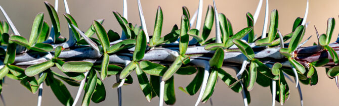
This time we just walked a 3-mile level loop. Lots of vegetation besides cacti — mesquite, palo verde, desert mistletoe, elephant tree, creosote, pink fairy duster, brittle bush, and bushrue, among lots I couldn’t identify. There is a lot more vegetation than cacti because the runoff from the surrounding mountains and hills keeps the area relatively wetter. During our walk we encountered three other hikers — a couple and a ranger.
We had intended to drive down to the Quitobaquito Oasis, but after our walk, we were not ready for an additional 8-miles of dirt road, and back. Plus one of the interpreters at the visitors’ center had said they were doing some work in the area and that the vegetation had not been replaced so it was not as lovely as before. Next time.
-- Janet (text) and David (photos)
Hello! Great photos. I’m considering hiking the Senita Basin Loop on an upcoming day trip to Organ Pipe. Can you tell me if that trail is well-marked/easy to follow, and do you think it’s safe for a solo female hiker? Thank you!
Yes it is safe and yes it is pretty well marked. You should have a paper map and follow on your phone with GPS. -David