Garner SP Blinn River Trail
Google maps suggested two routes to Garner State Oark from Amistad NRA. For one we followed 90 and headed north through Uvalde TX. For the other we took 90, 377, 50, and Farm Ranch Riad 373. We chose the latter even though it was 30 minutes slower basically because it wasn’t 90 which we have traveled many times.
The drive started out as typical flat, shrubby western Texas, then we began to climb up into and through some mountains. Spectacular gorges. Beautiful views. At one point the road was very steep and winding with a recommended speed of 20 miles per hour. There was a guardrail along the many hundred foot drop — Janet’s vertigo definitely set in.
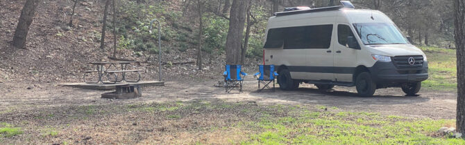
Our campsite at Garner State Park (#111) is very private as there is practically no one here. We are under some trees which if in leaf would give us lots of shade and we back into a tree covered hill. We have a picnic table and fire ring but there is a burn ban. There are lots of birds and some squirrels. While sitting out before dinner, we heard the screech of a cat and saw it running after come other animal on our hillside. Whether it was a bob cat or a feral house cat, we don’t know. We are told there are feral,pigs in the area — Janet wants to see one, but not up close.
We took a little more than 1 mile walk along the Frio River on the Blinn River Walk. Lovely walk but not flat and manicured as many we have been on. It was rated an easy walk, which it was until the steep gravel climb at the end to reach a path for a return round trip.
We will stay here for at least two nights so as to do some more exploring. The weather is nice — low 80s with a gentle breeze.
Good ATT internet with our booster.
-- Janet (text) and David (photos)
Recent Comments