Waterfall Trail
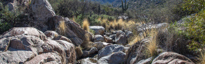
Early, before getting too hot, we took a trail recommended to us by another camper. The trail, starting right at the Romero Ruins Trailhead, is not on any of the park maps, but David found it on his Motion-X app terrain map. The trail leaves from the Romero Ruins trailhead and follows a gentle rise to the mountain. After about 1.5 miles we reached a waterfall, with water in it! From there we crossed the water and headed back down the mountain making several water and dry wash crossings as we went. The return trip was steeper than the climb. About 300 feet of elevation change over 3 miles of hiking. The views of the water softened boulders at the top were gorgeous and there were plenty of wildflowers — Fairy dusters, Brittle bush, Poppies, Primrose, and Purple or Blue Dick. There were many other flowers that I cannot identify.
The afternoon was spent grocery shopping and getting a haircut. The day had turned quite hot, so we also spent a bit of time reading in the shade before dinner.
-- Janet (text) and David (photos)
Recent Comments