Panguitch Area
Most of today we spent driving a big loop, south on 148, east on 14, north on 89, turning west onto 143 at Panguitch, then after a quick trip to see the ski resort at Brianhead, south on 148 to our the Point Supreme Campground in Cedar Breaks.
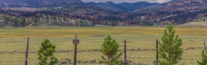
Along the route we saw sheep being moved into a pasture, lava flows, Navajo Lake and Panguitch Lake, views of burned trees as the result of a 30000 acre fire in June, and more views of the colorful cliffs of Cedar Breaks. At numerous points outside the National Monument we stopped to send up the drone.
Tonight’s entertainment in the campground was watching a full-length flatbed truck that had delivered some equipment to a work site in the campground maneuver around the tight curves. It couldn’t do it on its own. A backhoe was following it, lifting the backend of the truck around the curves. Quite a site — campers gave them a round of applause.
This will be our last night in The Cedar Breaks campground. We have enjoyed this facility and met an interesting couple from Arizona, Kim and Kirk. The campground has fire rings, flush toilets and hot showers, but no dump. Most of the 28 sites are level, but some are too small for anything larger than 25 feet. Some are reservable, some not. Favorite sites were 13, 14, 15, 17, and 19. The best part of being up at 10,000 feet is that the temperatures ranged from the 50s to the 70s, rather than the 70s to the 100s we had been experiencing at lower elevations.
-- Janet (text) and David (photos)
Recent Comments