Monahans to Hueco Tanks
A lot more driving today. It takes a while to get out of Texas. We left the interstate near Pecos and headed north and west. The roads are a bit rough and full of trucks servicing all of the oil wells and fracking installations at roadside. This is not generally the most lovely area of Texas, but the oil industry certainly has made its mark on it which has not been an improvement.
After a while we approached the Guadaloupe Mountains, which are indeed beautiful. We stopped to enjoyed the visitors’ center and told ourselves we would be back in sligthly warmer weather for some hiking. The elevation here is about 5000 feet and the hikes can go up to over 8000. While it was a chilly, breezy 49 at the visitors’ center, it was reported to be 39 nearer the top.
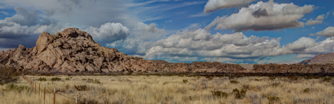
We continued on past beautiful, if stark, “salt flats” and finally reached Hueco Tanks State Park where we had a reservation for three nights — the maximum they allow. We were able to scramble around upon the rock piles for a few hours before dinner. Lots of boulder climbers with their big crash pads. They look a little like Sponge Bob Square pants from the distance.
Although Hueco Tanks is in range of El Paso TV, the campground is on the back side of the “mountain” (really a big pile of rocks) so we could not get reception. We did have AT&T internet service with our booster and roof-top antenna.
-- Janet (text) and David (photos)
Recent Comments