Dalton Highway I
In rain and mist we continued north on the Dalton Highway. The road surface varied from good gravel to potholed and rough gravel and good paved to broken and potholed paved. The advantage of the rain was that there was no dust on the gravel parts, but Vanessa accumulated a heavy layer of mud.
Describing the landscape is difficult. “Vast” is the best all-encompassing word. Everywhere there are huge expanses of whatever the flora is in the area and in most places the pipeline extends as far as one can see. Away from the road and pipeline and gravel pits there was no sign of civilization. As we set out in the morning we drove through spruce dotted tundra with low mountains. Further north the spruce became shorter and fewer. Just before we reached the Brooks Range (mile 235), the last of the spruce were seen, and after we went through the Atigun Pass (elevation 4739 ft, a continental divide), we entered true arctic treeless tundra. If it weren’t so misty, one could see for miles.
Unfortunately because of the mist and rain we are not seeing all of the hills and mountains, but there were some notable sights as we drove north.
• At about Mile 102 we began to see large granite tors on the horizon. One notable one is called Finger Rock and had an interpretive center.
• At Mile 145 we crossed the Jim River which is a good fishing area, but you must travel 5 miles away from the road to fish for salmon. Salmon travel over 1000 miles from the Bering Sea in order to spawn in the Jim River.
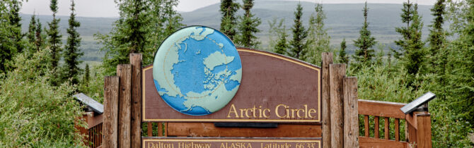
• At Mile 115 we crossed the Arctic Circle. There is a campground there which many like to use so they can say that they camped on the Arctic Circle.
• At Mile 175 is Coldfoot Camp, one of the original gold rush camps which experienced a brief revival in the 70s when the pipeline was being built. The name comes from the legend that this was the point where many gold rushers got “cold feet” and headed back home. Coldfoot currently provides a restaurant, dormitory style hotel, fuel station, and the Interagency Arctic Circle Visitor Center. The latter is a beautiful, modern building with displays and information about the area hosted by the BLM, USF&WS, and NPS. We studied the exhibits, ate our lunch, enjoyed a movie about life above the Arctic Circle, and headed across the street to fill up on diesel.
• Along the side of the side of the road around Mile 220 we saw piles of black marble veined with white calcite that is used for the underlayment in the roads and as riprap along streams. It seems like too nice a rock for that use.
• At about Mile 237 we began the steep uphill drives to the Atigun Pass which had stunning, though misty, views of the valley below. At one place called the Chandalar Shelf there is such threat of avalanche in the winter that state transportation workers are stationed there to shoot artillery shells to clear the slopes above the highway. There are signs at the north and south entries to the pass instructing one to report in on CB channel 19 before entering. I guess this is to communicate with the marksmen in winter.
We stopped for the night at a BLM campground at Galbraith Lake (Mile 275). A fine place to camp except for the mosquitoes. I have never seen so many. At one point I counted 13 on the glass (outside, fortunately) of one of our windows. Going outside is unpleasant and mosquito head-nets are essential. Going outside also lets in a cloud of mosquitoes which then have to be hunted down. I guess we should have been forewarned as the flagger working beside the highway nearby was clothed in what our friend described as “industrial strength mosquito netting.”
We are currently about 140 miles from the Arctic Ocean with promises of major road construction ahead.
Galbraith Lake Campground Review: Again this is a large gravel area with a pit toilet, picnic tables, and fire rings. Four miles from the highway; first 3 miles are in good shape, as far as the road crew camp, but the last is a bit rough. No fee area. It is surrounded by beautiful mountains and the sound of a rushing stream.
-- Janet (text) and David (photos)
Recent Comments